

Honeywell Radar Velocity System
Overview
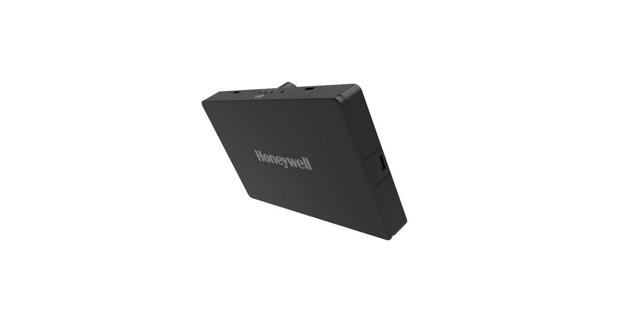
The Honeywell Radar Velocity System (HRVS) is a compact, lightweight, and low-power radar-based navigation-aiding solution designed as a velocity aiding accessory to the HGuide range of INS/GNSS Navigators to support resilient land and aerial navigation.
HRVS delivers precise range, velocity, and angle measurements with centimeter-level accuracy—regardless of environmental conditions such as rain, fog, dust, or snow.
Unlike vision-aided navigation systems, HRVS requires no maps or prior environmental data. It operates effectively from ground level up to 1 km altitude across all terrains (excluding still water) and in all weather conditions, making it a versatile and robust velocity-aiding source for inertial navigation systems.
HRVS is part of Honeywell’s Resilient UAV Navigation Suite, which also includes the HGuide o480, HGuide HCINS and HGuide n580.
When combined with HRVS, these Navigators can navigate in fully GPS-denied environments with a position error of between 0.5% and 3% of distance traveled.
HRVS delivers precise range, velocity, and angle measurements with centimeter-level accuracy—regardless of environmental conditions such as rain, fog, dust, or snow.
Unlike vision-aided navigation systems, HRVS requires no maps or prior environmental data. It operates effectively from ground level up to 1 km altitude across all terrains (excluding still water) and in all weather conditions, making it a versatile and robust velocity-aiding source for inertial navigation systems.
HRVS is part of Honeywell’s Resilient UAV Navigation Suite, which also includes the HGuide o480, HGuide HCINS and HGuide n580.
When combined with HRVS, these Navigators can navigate in fully GPS-denied environments with a position error of between 0.5% and 3% of distance traveled.
Specifications
LED
- Yes
Typical Heading Error with HCINS
- 5 minutes < 1° (for outages > 15 minutes mag. heading aiding is recommended)
Velocity errors X/Y/Z axes 9m/s
- 0.09/0.04/0.03 Mean
- 0.45/0.45/0.10 RMS
Velocity errors X/Y/Z axes 6m/s
- 0.06/0.02/0.02 Mean
- 0.35/0.35/0.07 RMS
Velocity errors X/Y/Z axes 3m/s
- 0.02/0.02/0.003 Mean
- 0.20/0.20/0.04 RMS
Maximum Measurement Range
- 170m
Key Performance Variables
- Heading error, trajectory shape (open vs closed)
Typical Performance
- *1% of Distance Travelled
2-sigma Performance
- *3% of Distance Travelled
Types of Products
- Honeywell Radar Velocity System for Commercial Vehicles (HRVS-CV)
- Honeywell Radar Velocity System for Military Vehicles (HRVS-M)
- Honeywell Radar Velocity System for UAVs (HRVS-U)
- Radar (mmWave)
Key Benefits
- Altitude <300m
- Based on mmW sensor (60-64 GHz)
- Cm level-range accuracy
- Day/night operations
- Enables features: Velocity aid, altitude measurement, depth mapping , ground avoidance
- Error approx 1-2% distance travelled
- Guaranteed functionality with chosen Honeywell product lines such as Honeywell Compact Inertial Navigation System (HCINS)
- Helps in drones to navigate in GNSS outage scenarios with minimum deviation.
- Impervious to environmental conditions such as rain, fog, dust, and snow
- Impervious to environmental conditions such as rain, fog, dust, and snow
- Indefinite precise hover as error doesn’t grow with time (unlike INS)
- Indefinite precise hover as error doesn’t grow with time (unlike INS)
- Provides precise vertical velocity (e.g., for autoland)
- Provides range and velocity aiding to INS devices.
- Range measurement resolution down to 4cm
- Range up to 170m above the ground
- Supports high velocity ranges (theoretical limit ~250m/s)
Features
- Helps in drones to navigate in GNSS outage scenarios with minimum deviation.
- Provides range and velocity aiding to INS devices.
- Velocity aid (UAS)
- Velocity aid for no GNSS operations (Commercial vehicles)
- Velocity aid for no GNSS operations (Military vehicles)
Shock
- Yes
Surfaces with Limitations
- Lake (i.e. still water)
Operating Temperature
- -40°C to +85°C
Serial Communication
- yes
Operating Frequency
- 62.0±0.5GHz
Communication Ports
- Serial, CAN
Software
- Internal software (Honeywell proprietary)
Output
- Range and veocity information
Usually Bought With
- GPSDome
- HCINS
Tested Surfaces
- Asphalt
- Concrete
- Forest/trees
- Grass
- Greenfield
- Snow
Tested Range
- Up to 170m (UAS)
Used INS
- HCINS (MEMS based low-cost navigator – tactical grade - gyro bias instability 1 deg/h
Setup
- 1 x HRVS board (1.5m/0.6m above the ground) + INS (HCINS etc.) (Commercial vehicles)
- 1 x HRVS board (1.5m/0.6m above the ground) + INS (HCINS etc.) (Military vehicles)
- 4 x HRVS board + INS (HCINS, etc.) (UAS)
Power Consumption
- 1.7W nominal Watt
Supply Voltage
- +5VDC
Power
- 1.7W nominal Watt
Chassis Included
- Yes
Field of View
- 5.5° H x 5.5° V (-3dB)
Dimensions
- 113mm x 66mm x 13mm (Enclosed version)
Weight
- 24g (OEM version)
- 68g (Enclosed version)
Length
- 113 mm
Depth
- 13 mm
Size
- 108mm x 60mm x 10mm (OEM version) millimetre
- 113mm x 66mm x 13mm (Enclosed version) millimetre
Product Number
Parts
_self
Filters